
In this VFR - GPS Flight Plan we take off from the airport of Aba Segud - Jimma (HAJM) [Ethiopia] and fly northwards over the Ethiopian highlands to land in the airport of Bahir Dar (HABD) [Ethiopia]
At the bottom of this page you will find the download link of this Flight Plan (.PLN file)

In this VFR - GPS Flight Plan we take off from
the airport of Aba Segud - Jimma (HAJM) [Ethiopia] and fly northwards over the
Ethiopian highlands to land in the airport of Bahir Dar (HABD) [Ethiopia]
Find below a short extract and screenshots of the main points of the route. In this journey around Africa I have used the Cessna 172S (Skyhawk)

Take off from airport of Aba Segud - Jimma.
Aba Segud Airport (IATA: JIM, ICAO: HAJM), also known as Jimma Airport, is an airport serving Jimma, a city in the Oromia Region of Ethiopia. The airport is located 2.5 km (1.6 miles) southwest of the city.
The Aba Segud Airport sits at an elevation of 5,587 feet (1,703 m) above mean sea level. It has one runway designated 13/31, with an asphalt surface measuring 3,300 by 50 metres (10,827 ft × 164 ft). (*1)

We will have nice landscapes along all this stage.

Overflying Gennet.

As we travel to he north there are more and more farmlands and less woods.

This strange pattern of circles on the terrain happens several times in our
path. I have no idea of what it is.

Approaching the lake Finicha'a.
Lake Finicha'a (also transliterated Fincaawaa, Finca'a and Fincha'a) was created when Finicha'a Dam flooded the Chomen swamp. The Dam was inaugurated by Emperor Haile Selassie in November 1973. At the time the dam was the largest hydro-electric project in the country, built at a cost of over Birr 81 million and with a power output of 84 MW, more than the combined output of the other four power stations which existed at the time. The hydroelectric power plant was overhauled in March 1999 by the Ethiopian Electric Power Corporation at a cost of US $3 million, increasing its hydroelectric capacity to 100 MW. (*1)

We leave the lake behind.

Terrain descends about 5000 feet from the location of the dam.

This is the first dam I have ever seen that is not in a valley. Just
something curious.

The Blue Nile river flowing at the bottom of the valley.

Overflying Jiga.

The highest point of this stage, at about 10,000 feet of altitude.

Overflying Adet when descending to our destination.
Adet (also known as Adet Medhanialem) is a town in northwestern Ethiopia. Located south of Bahir Dar in the Mirab Gojjam Zone of the Amhara Region (or kilil), this town has a latitude and longitude of 11°16′N 37°29′ECoordinates: 11°16′N 37°29′E with an altitude of 2,216 meters above sea level. It is the largest settlement in Yilmana Densa woreda. Adet,gojjam,Ethiopia
Adet is surrounded by two rivers, called Shenna and Shegize.
The southern part of Adet is called Felseta Mariam deber and Zerabruke (Anbesit Mewucha). The northern part is called Kurrastiyon or Ersha Mermer. The southeastern part is called Ereberbe Gabriel (Yegetoch Bahir zafe). The East of Adet is called Mender Eyesus, and the west Adet Hanna. (*1)

Continuing the descend we can already see the lake Tana in the horizon.

Overflying the Blue NIle river

Approaching to Dahir Dar flying over the lake Tana
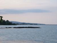
Lake Tana (Amharic: ጣና ሐይቅ) (previously Tsana) is the largest lake in Ethiopia and the source of the Blue Nile. Located in Amhara Region in the north-western Ethiopian Highlands, the lake is approximately 84 kilometres (52 miles) long and 66 kilometres (41 miles) wide, with a maximum depth of 15 metres (49 feet), and an elevation of 1,788 metres (5,866 feet). Lake Tana is fed by the Gilgel Abay, Reb and Gumara rivers. Its surface area ranges from 3,000 to 3,500 square kilometres (1,200 to 1,400 square miles), depending on season and rainfall. The lake level has been regulated since the construction of the control weir where the lake discharges into the Blue Nile. This controls the flow to the Blue Nile Falls (Tis Abbai) and hydro-power station.
In 2015, the Lake Tana region was nominated as a UNESCO Biosphere Reserve recognizing its national and international natural and cultural importance. (*1)
 |
 |
 |
| Views over Lake
Tana By Andro96~commonswiki - CC BY 2.0 |
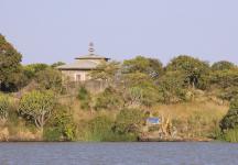
The Island Church on Lake Tana By A. Davey - CC BY 2.0 |
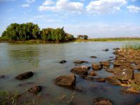
Beginning of the
Blue Nile river by its outlet from Lake Tana By Ondřej Žváček - CC BY 2.5 |

Final approach to the runway 22 of the airport of Bahir Dar. We tried
an ILS approach but, as usual with FS2020, it did not work, so we had to land
visually.
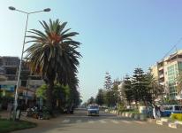
Bahir Dar (Amharic: ባሕር ዳር, Baḥər Dar, "sea shore"), originally inhabited by the Wayto people, is the capital of the Amhara Region in Ethiopia. Bahir Dar is one of the leading tourist destinations in Ethiopia, with a variety of attractions in the nearby Lake Tana and Blue Nile river. The city is known for its wide avenues lined with palm trees and a variety of colorful flowers. In 2002 it was awarded the UNESCO Cities for Peace Prize for addressing the challenges of rapid urbanization.
Bahir Dar is located at the exit of the Abbay from Lake Tana at an altitude of 1,820 metres (5,970 ft) above sea level. The city is located approximately 578 km north-northwest of Addis Ababa. The Lake Tana region is a UNESCO Biopshere Reserve since 2015.
Based on the 2007 Census conducted by the Central Statistical Agency of Ethiopia (CSA), Bahir Dar Special Zone has a total population of 221,991, of whom 108,456 are men and 113,535 women; 180,174 or 81.16% are urban inhabitants, the rest of population are living at rural kebeles around Bahir Dar. At the town of Bahir Dar there are 155,428 inhabitants; the rest of urban population is living at Meshenti, Tis Abay and Zege towns which are part of Bahir Dar Special Zone. As Philip Briggs notes, Bahir Dar "is not only one of the largest towns in Ethiopia, but also one of the fastest growing – the western outskirts have visibly expanded since the first edition of this guide was published in 1994." (*1)
 |
 |
 |
| A street in
Bahir Dar By O.Mustafin - CC0 |
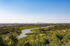
Blue Nile with Bahir Dar and lake
Tana in the background By Geertchaos - CC BY-SA 4.0 |
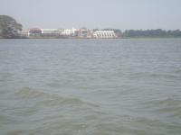
Resort hotel in
Bahir Dar By ZeGhion |
You can download for free this Flight Plan but only for your own private use. It is strictly forbidden to share it or publish it in other sites, forums, newsgroups or in any other way . You are encouraged to share and publish links to this page only, but not direct links to the file itself.
(*1) Credits: The descriptive texts are mainly an excerpt of those provided by Wikipedia. Visit Wikipedia to read the full descriptions.
See other MS Flight Simulator flight plans and instructions
Disclaimer: These instructions and flight plan are intended to be used only for MS Flight Simulator and should not be used for real flights.