
In this VFR - GPS Flight Plan we take off from the airport of Mersa Matruh (HEMM) [Egypt] and fly to the east following the coast to finally land in the airport of Port Said (HEPS) [Egypt]. We overfly the city of Alexandria and the Nile river delta.
At the bottom of this page you will find the download link of this Flight Plan (.PLN file)

In this VFR - GPS Flight Plan we take off from
the airport of Mersa Matruh
(HEMM) [Egypt] and fly to the east following the coast to finally land in the
airport of Port Said (HEPS) [Egypt]. We overfly the city of Alexandria and the
Nile river delta.
Find below a short extract and screenshots of the main points of the route. In this journey around Africa I have used the Cessna 172S (Skyhawk)

After taking off from the airport of
Mersa Matruh we take to the east in order to fly in parallel to
the coast.
Marsa Matruh International Airport, formerly Mersa Matruh Airport (Arabic: مطار مرسى مطروح الدولي) (IATA: MUH, ICAO: HEMM), is an international airport in Mersa Matruh, Egypt. In 2011, the airport served 99,515 passengers (−13.7% compared to 2010).
The Mersa Matruh VOR-DME (Ident: MMA) is located on the field. (*1)

Leaving Mersa Matruh behind.

The flight plan takes us to
overfly the Mediterranean sea a couple of times.

The residential complex Emirates
Heights North Coast Capital

Flying near El Badaa.
El Dabaa (Arabic: الضبعة) is a city in the Matrouh Governorate, Egypt. It lies 296 kilometres (184 mi) from Cairo on the north coast and is served by the El Alamain International Airport. It is famous for the proposed nuclear power plant that is intended to be constructed to the north east of the city boundaries.
In 2012, a story pubblished in the news section of Nature Journal website, stated that:"... [radioactive] material was taken from a laboratory at the El Dabaa nuclear power plant on the country’s Mediterranean coast." But as of 2020, the El Dabaa nuclear power plant was only bare land. As of 2017, only the first stage of preliminary engineering survey was conducted and the hydrographic and hydrological survey work was carried on. The construction on the plant was expected to start in 2020, but at the beginning of 2021 it was still in the waiting.
El Dabaa has been targeted by protesters who are claiming that their land was wrongly taken by the government to make way for the nuclear plant. As of 2012, and as a result of those protests, the proposed construction site was shut down. The protests that targeted El Dabaa was ended by the court announcing that they had the right to the land. (*1)

Ghazala Valley and Rixos Alamein resorts.

Port of El Dekheila, near Alexandria.
By the late 20th century sea trade through the Port of Alexandria was exceeding its capacity. A new port was built at El-Dekheila during the 1980s with facilities for container shipping and infrastructure to serve the nearby steel factory. In addition to the Port of Dekheila and the Western Port of Alexandria, the city's ports include those at Abu Qir and Sidi Krer, as well as Alexandria's old Eastern Port which is no longer used for shipping freight. (*1)

Getting closer to the city of Alexandria.
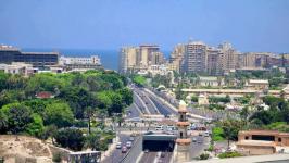
Alexandria (Arabic: الإسكندرية al-ʾIskandarīyah; Egyptian Arabic: اسكندرية Eskendereyya; Greek: Αλεξάνδρεια Alexándria) is the third-largest city in Egypt after Cairo and Giza, the seventh-largest city in Africa, and a major economic centre. With a total population of 5,381,000, Alexandria is the largest city on the Mediterranean – also called the "Bride of the Mediterranean" by locals – the fourth-largest city in the Arab world and the ninth-largest urban area in Africa. The city extends about 40 km (25 mi) at the northern coast of Egypt along the Mediterranean Sea. Alexandria is a popular tourist destination, and also an important industrial centre because of its natural gas and oil pipelines from Suez.
Alexandria was founded in 331 BC by Alexander the Great, king of Macedon and leader of the Greek League of Corinth, during his conquest of the Achaemenid Empire. An Egyptian village named Rhacotis existed at the location and grew into the Egyptian quarter of Alexandria. Alexandria grew rapidly to become an important centre of Hellenistic civilization and remained the capital of Ptolemaic Egypt and Roman and Byzantine Egypt for almost 1,000 years, until the Muslim conquest of Egypt in AD 641, when a new capital was founded at Fustat (later absorbed into Cairo). Hellenistic Alexandria was best known for the Lighthouse of Alexandria (Pharos), one of the Seven Wonders of the Ancient World; its Great Library (the largest in the ancient world); and the Necropolis, one of the Seven Wonders of the Middle Ages. Alexandria was the intellectual and cultural centre of the ancient Mediterranean world for much of the Hellenistic age and late antiquity. It was at one time the largest city in the ancient world before being eventually overtaken by Rome.
The city was a major centre of early Christianity and was the centre of the Patriarchate of Alexandria, which was one of the major centres of Christianity in the Eastern Roman Empire. In the modern world, the Coptic Orthodox Church and the Greek Orthodox Church of Alexandria both lay claim to this ancient heritage.
By the time of the Arab conquest of Egypt in 641 AD, the city had already been largely plundered and lost its significance before re-emerging in the modern era. From the late 18th century, Alexandria became a major centre of the international shipping industry and one of the most important trading centres in the world, both because it profited from the easy overland connection between the Mediterranean Sea and the Red Sea, and the lucrative trade in Egyptian cotton. (*1)
 |
 |
 |
| Suez Canal St. in Alexandria By Islam90 - CC BY-SA 3.0 |
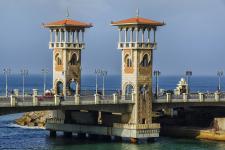
Stanly Bridge -
Alexandria By Ahmed Yousry Mahfouz - CC BY-SA 4.0 |
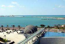
Mediterranean sea By Moro 2088 - CC0 |

Leaving Alexandria behind

Right after leaving Alexandria we begin overflying the Nile delta. After so
many days of flying through deserts and dry terrain, it is a joy to finally see
a green terrain full of water everywhere.
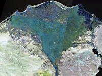
The Nile Delta (Arabic: دلتا النيل Delta an-Nīl or simply الدلتا ad-Delta) is the delta formed in Lower Egypt where the Nile River spreads out and drains into the Mediterranean Sea. It is one of the world's largest river deltas—from Alexandria in the west to Port Said in the east, it covers 240 km (150 mi) of Mediterranean coastline and is a rich agricultural region. From north to south the delta is approximately 160 km (99 mi) in length. The Delta begins slightly down-river from Cairo. (*1)
 |
||
| Satellite photograph of the
Nile Delta (shown in false color) Credits: NASA |

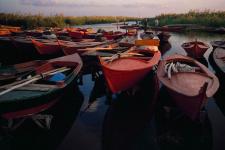
Lake Idku
Lake Idku (Arabic: بحيرة إدكو) is one of the lakes in Egypt. Its area is 62.78 square kilometres (24.24 sq mi) and it connects to the Mediterranean Sea. The lake lies to the west of the city of Edku. (*1)
 |
||
| Lake Idku By Mhmd yassen - CC BY-SA 4.0 |

Leaving the city of Edku behind. Notice that the whole area is
crisscrossed with waterways.
Edku (Arabic: إدكو) (also Edkhou, or Idku) is a town in the Beheira Governorate, located east of Alexandria and west of Rashid, overlooking the Mediterranean Sea and there are natural gas liquefaction plant (LNG). Edku lies on a sandy strip behind Abi Qir Bay, in the northwestern Nile River delta. Immediately south is Lake Idku, a 58-square-mile (150-square-km) lagoon that stretches some 22 miles (35 km) behind and parallel to the coast and has a maximum width of 16 miles (26 km). Drained by Al-Madiyyah Channel, connecting with the Mediterranean, the lagoon is reputed to be the ancient Canopic branch of the Nile. Edku's isthmus position enables it to capitalize on the fisheries of both the lagoon and the Mediterranean. Other industries include rice milling and silk weaving. Edku is linked by coastal road and railway to Alexandria, 26 miles (42 km) to the west-southwest, and Rosetta (Rashid ), 12 miles (19 km) northeast.
Edku was one of the ancient cities of the Pharaonic era. It was within the province of "Ra Amenati", where many ancient pharaonic cities have become uninhabited to be replaced by other cities, including the city of "Tajo", which is Edku currently, and some historians believe that the name of Edco Pharaonic is " Jackat " which means in Ancient Egyptian language the high hill, and it is clear that the urbanization is related to the sandy hills north of Lake Idku and also tells one of the historians that its ancient name is mentioned in the bishop's revelation in the name of Etco.
Idku was conquered in the succession of Omar bin Al-Khattab by order of him to the leader Amr bin Al-Aas at the hands of "Abdullah bin Omar" and the governor of Idko was "Zarand". The king and his army took refuge in the forts and closed the walls, and the Arabs surrounded and the siege lasted for six months.
The 1885 Census of Egypt recorded Edku as a nahiyah in the district of Atf in Gharbia Governorate; at that time, the population of the town was 5,751 (2,937 men and 2,814 women). (*1)

One of the branches of the Nile river while flying over Al Hammad Al Gharbi

That same branch of the Nile river flowing into the sea.

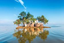
The huge lake Burullus
Lake Burullus (Arabic: بحيرة البرلس, romanized: Buḥayrat al-Burullus; Greek: λίμνη Σεβεννυτική) is a brackish water lake in the Nile Delta in Egypt, the name coming from Burullus town (from Ancient Greek παράλιος, "coast, seaside"). It is located in Kafr el-Sheikh Governorate east of Rosetta, bordered by the Mediterranean Sea in the north and agricultural land to the south.
In the early Islamic period, the port of Burullus was situated near the mouth of the lake (the place where it was connected to the sea through a small opening). Burullus port functioned as one of the defensive frontier settlements of the Nile Delta coast. An island settlement within the lake called Nastaru lent its name to the lake as a whole. Canals connected the lake to the Rosetta branch of the Nile. At this time the lake was growing and expanding southwards as a result of changes in fluvial deposition and generalized substrate subsidence.
The lake is separated from the sea by a strip of land approximately 5.5 km (3.4 mi) wide. It is connected to the Mediterranean by the Burullus outlet, a channel about 250 m (820 ft) wide and 5 m (16 ft) deep. There are approximately 50 islands in the lake with a total area of 0.7 km2 (0.27 sq mi). The lake's north shore is formed primarily of salt marshes and mudflats, while the south is mainly reed beds. The dominant lake vegetation is Potamogeton.
The lake receives drainage waters from surrounding agricultural land and fresh water from the Brembal Canal. It is considered to be a lake and wetlands site of International importance for birds under the Ramsar Convention. Agriculture drainage water accounts for 97% of the total inflow to the lake (3.9 billion m3 per year), followed by rain water (2%) and groundwater (1%). 16% of the lake's water evaporates and 84% flows to the sea.
According to a Biodiversity Report of the Egyptian Environmental Affairs Agency 33 species of fish, 23 species of reptiles, 112 species of birds, and 18 species of mammals live in and around the lake. Fish species declined from 52 recorded at the beginning of the 20th century, mostly due to the inflow of agricultural drainage into the lake resulting in lower salinity. (*1)
 |
 |
|
| Lake Burullus By Adel Bayoumi |
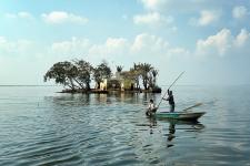
Fishers and small
island in Lake Burullus By Myousry6666 - CC BY-SA 4.0 |

Flying near Baltim
Baltim (Arabic: بلطيم) is a resort in the Kafr El Sheikh Governorate, in the north coast of Egypt.
Baltim was the beneficiary of a tax reduction under the reign of the sultan Barquq. Ibn Battuta noted it as the capital of the district of Burullus, a position which it held through the late 1800s.
The 1885 Census of Egypt recorded Baltim as a nahiyah in the district of Aklim el-Borollos in Gharbia Governorate; at that time, the population of the city was 4,286 (2,182 men and 2,104 women).
Baltim's climate is typical to the northern coastal line which is the most moderate in Egypt. It features a hot desert climate (Köppen: BWh), but prevailing winds from the Mediterranean Sea greatly moderate the temperatures, making its summers moderately hot and humid while its winters mild and moderately wet.
The hottest temperature recorded was on April 15, 1998 which was 41 °C (106 °F) and the coldest temperature was on February 8, 2006 which was 2 °C (36 °F). (*1)

Leaving behind the touristic city of Gamasa.

Another city (unknown name) in our course to Port Said

Another branch of the Nile flowing into the sea.

Flying over another lake when getting closer to Port Said.

As usual FS2020's ATC assigns us the most complicated runway that forces us
to fly over the city of Port Said.
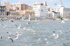
Port Said (Arabic: بورسعيد Borsaʿīd) is a city that lies in north east Egypt extending about 30 kilometres (19 mi) along the coast of the Mediterranean Sea, north of the Suez Canal. With an approximate population of 603,787 (2010), it is the fifth-largest city in Egypt. The city was established in 1859 during the building of the Suez Canal.
There are numerous old houses with grand balconies on all floors, giving the city a distinctive look. Port Said's twin city is Port Fuad, which lies on the eastern bank of the Suez Canal. The two cities coexist, to the extent that there is hardly any town centre in Port Fuad. The cities are connected by free ferries running all through the day, and together they form a metropolitan area with over a million residents that extends both on the African and the Asian sides of the Suez Canal. The only other metropolitan area in the world that also spans two continents is Istanbul.
Port Said acted as a global city since its establishment and flourished particularly during the nineteenth and the first half of the twentieth century when it was inhabited by various nationalities and religions. Most of them were from Mediterranean countries, and they coexisted in tolerance, forming a cosmopolitan community. Referring to this fact Rudyard Kipling once said "If you truly wish to find someone you have known and who travels, there are two points on the globe you have but to sit and wait, sooner or later your man will come there: the docks of London and Port Said"
The name of Port Said first appeared in 1855. It was chosen by an international committee composed of Great Britain, France, the Russian Empire, Austria, Spain and Piedmont. It is a compound name which composed of two parts: Port (marine harbour) and Said (the name of the ruler of Egypt at that time), who granted Ferdinand de Lesseps the concession to dig the Suez Canal. (*1)
 |
 |
 |
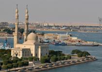
| A mosque on the western Bank of
the Suez Canal, Port Said U. S. Navy photo by Photographer's Mate 3rd Class Lance H. Mayhew Jr. |
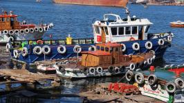
Fishermen boats in
Port Said By Passantadnan - CC BY-SA 4.0 |
CC BY-SA 3.0 |

Final approach to the airport of Port Said, located in a strip of land
parallel to the sea.
You can download for free this Flight Plan but only for your own private use. It is strictly forbidden to share it or publish it in other sites, forums, newsgroups or in any other way . You are encouraged to share and publish links to this page only, but not direct links to the file itself.
(*1) Credits: The descriptive texts are mainly an excerpt of those provided by Wikipedia. Visit Wikipedia to read the full descriptions.
See other MS Flight Simulator flight plans and instructions
Disclaimer: These instructions and flight plan are intended to be used only for MS Flight Simulator and should not be used for real flights.