
In this VFR - GPS Flight Plan we take off from the airport of Alicante (LEAL) [Spain], fly to the southwest following the coast of Spain and land in the airport of Gibraltar (LXGB).
At the bottom of this page you will find the download link of this Flight Plan (.PLN file)

In this VFR - GPS Flight Plan we take off from
the airport of Alicante (LEAL) [Spain], fly to the southwest following the coast
of Spain and
land in the airport of Gibraltar (LXGB).
Find below a short extract and screenshots of the main points of the route. In this journey around Africa I have used the Cessna 172S (Skyhawk)

Taking off from the airport of Alicante.
Alicante–Elche Miguel Hernández Airport (Spanish: Aeropuerto de Alicante-Elche Miguel Hernández, Valencian: Aeroport d'Alacant-Elx Miguel Hernández), (IATA: ALC, ICAO: LEAL), is —as of 2019— the fifth-busiest airport in Spain based on passenger numbers, and the main airport serving the Valencian Community and the Region of Murcia. The airport is located in the municipality of Elche, about 10 kilometres (6.2 miles) east of this city and about 9 km (5.6 mi) southwest of Alicante. Its influence area spans other cities in the Valencia province—the city of Valencia is located about 160 km (99 mi) north of the airport—and in the Region of Murcia. The airport is located about 70 km (43 mi) north of Murcia.
The airport is a base for Air Nostrum, Norwegian Air Shuttle, Ryanair and Vueling. Passenger traffic has increased significantly in the last decade, beating its own yearly record since 2013 to date; in 2019 it set its new consecutive record at 15 million passengers. It is one of the 50 busiest in Europe. Up to 80% of all passenger flights are international.The largest numbers of passengers arrive from the United Kingdom, Germany, the Netherlands, Norway, Belgium and Sweden. Popular domestic destinations are Madrid, Palma de Mallorca and Barcelona. (*1)

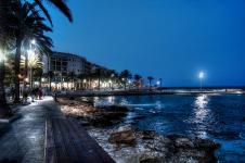
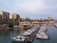
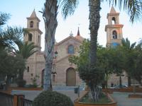
Following the coast soon we pass near Torrevieja and its lagoons.
Torrevieja (Spanish: [ˌtoreˈβjexa]) or Torrevella (Valencian: [ˌtoreˈveʎa]) is a seaside city and municipality located on the Costa Blanca in the province of Alicante, in the southern part of the Valencian Country, on the southeastern Mediterranean coast of Spain.
Torrevieja lies about 50 kilometres south of the city of Alicante and had a population of 90,097 at the 2011 Census; the latest official estimate (for 2019) is 83,337. Torrevieja was originally a salt-mining and fishing village as it is located between the sea and two large salt lakes (Las Salinas, a pink lake), which give Torrevieja a healthy microclimate.
Until 1802, Torrevieja existed only as an ancient guard tower, which gave the town its name (Torre Vieja (Spanish) means Old Tower) and some labourers' cottages. But in 1803, Charles IV authorised the movement of the salt production offices from La Mata to the town itself and allowed the construction of dwellings there. In 1829, the town was totally destroyed by an earthquake, but the basins were soon reconstructed and re-opened. In 1931, Alfonso XIII gave Torrevieja city status by special grant. During this period, there was also a growing market for flax, hemp and cotton.
In the 19th century, the salt was mainly shipped from the town by Swedish and Dutch ships. At the time, there was only limited demand from other regions of Spain, mainly Galicia and to a lesser extent, Valencia. Although by the dawn of the 20th century, a quarter of all the salt harvested from the lagoon in Torrevieja was sold in Spain itself, and the rest was exported to foreign markets. Today, it is still an important industry in Torrevieja and a major employer. You can visit the Museum of Sea and Salt.
In recent years the local economy has hugely expanded due to the tourist industry. This includes both a strong contingent of British, Irish, Germans and Scandinavians, many of whom live there all year round, and Spanish people who have a second home in the city. By 2004, Torrevieja had the largest number of British residents of all Spanish municipalities (approx. 7,180) The high number of British expatriates has led to Torrevieja being nicknamed as 'the costa del Yorkshire' by some holidaymakers and paella can be found served in giant Yorkshire puddings in many of the city's restaurants.
Since 2001, the city's authorities, along with Random House's Spanish subsidiary, Plaza & Janés, award Spain's second most important annual literary award, the Premio de Novela Ciudad de Torrevieja, and its poetry correlative, Premio de Poesía Ciudad de Torrevieja. (*1)
 |
 |
 |
| Beach promenade in Torrevieja By Jose M Martin Jimenez - CC BY-SA 2.0 |
The port By Deran~commonswiki |
Church of Inmaculada Concepción By Uaxuctum~commonswiki - CC BY-SA 3.0 |

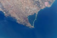
Approaching Mar Menor.
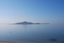
Mar Menor (Spanish pronunciation: [ˌmaɾ meˈnoɾ], "Minor sea" or "Smaller Sea"; the Mediterranean Sea is also called Mar Mayor ["Larger Sea"] in the region) is a coastal saltwater lagoon in the Iberian Peninsula located south-east of the Autonomous Community of Murcia, Spain, near Cartagena.
Four municipalities lie by the Mar Menor, Cartagena, Los Alcázares, San Javier and San Pedro del Pinatar. With a surface area of 135 km2, a coastal length of 70 km, and warm and clear water no more than 7 metres in depth, it is the largest lagoon in Spain.
The lagoon is separated from the Mediterranean Sea by La Manga ("the sleeve", in Spanish), a sandbar 22 km in length whose width ranges from 100 to 1,200 metres, with Cape Palos in its south-eastern vertex making for the lagoon's roughly triangular shape. There are five islets located within the lagoon, namely Perdiguera islet, Mayor or El Barón islet, Ciervo islet, Redonda islet and del Sujeto islet.
Its relatively high salinity which aids flotation, low waves, and remarkable sporting infrastructures makes it a popular place for a wide variety of water sports.
At the northern end there are salt-flats which include a wetland of international importance. This area is preserved as a natural park administered by the regional government. Its Spanish name is "Salinas y Arenales de San Pedro del Pinatar". The microbes that live in this coastal lagoon have been recently described.
The islets and the few coastal places without permanent human constructions are protected by the natural park Islets and open areas of the Mar Menor
In 1994 the Mar Menor was included on the Ramsar Convention list for the conservation and sustainable utilisation of wetlands. The Mar Menor is also part of a Specially Protected Area of Mediterranean Importance and is a Special Protection Area (ZEPA in Spanish) for bird life. (*1)
 |
 |
|
| Mar Menor from International
Space Station By NASA |
El Barón Island By Felipe Ortega - CC BY-SA 2.0 |

Overflying Cartagena.
Cartagena (Spanish pronunciation: [kaɾtaˈxena]) is a Spanish city and a major naval station located in the Region of Murcia, by the Mediterranean coast, south-eastern Iberia. As of January 2018, it has a population of 213,943 inhabitants,being the region's second-largest municipality and the country's sixth-largest non-provincial-capital city. The metropolitan area of Cartagena, known as Campo de Cartagena, has a population of 409,586 inhabitants.
Cartagena has been inhabited for over two millennia, being founded around 227 BC by the Carthaginian Hasdrubal the Fair as Qart Hadasht (meaning 'New Town'), the same name as the original city of Carthage. The city had its heyday during the Roman Empire, when it was known as Carthago Nova (the New Carthage) and Carthago Spartaria, capital of the province of Carthaginensis. It was one of the important cities during the Umayyad invasion of Hispania, under its Arabic name of Qartayannat al-Halfa.
Much of the historical weight of Cartagena in the past goes to its coveted defensive port, one of the most important in the western Mediterranean. Cartagena has been the capital of the Spanish Navy's Maritime Department of the Mediterranean since the arrival of the Spanish Bourbons in the 18th century. As far back as the 16th century it was one of the most important naval ports in Spain, together with Ferrol in the North. It is still an important naval seaport, the main military haven of Spain, and is home to a large naval shipyard.
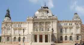
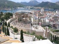
The confluence of civilizations as well as its strategic harbour, together with the rise of the local mining industry is manifested by a unique artistic heritage, with a number of landmarks such as the Roman Theatre, the second largest of the Iberian Peninsula after the one in Mérida, an abundance of Phoenician, Roman, Byzantine and Moorish remains, and a plethora of Art Nouveau buildings, a result of the bourgeoisie from the early 20th century. Cartagena is now established as a major cruise ship destination in the Mediterranean and an emerging cultural focus.
It was the first of a number of cities that have been named Cartagena, most notably Cartagena, Colombia. (*1)
 |
 |
 |
| Cartagena's City
Hall By Moríñigo |
The Roman Theatre of Carthago Nova and Cathedral ruins of Cartagena By Trasamundo - CC BY-SA 3.0 |
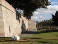
Carlos III
Citadel By Murcianboy - CC BY-SA 3.0 |

Flying over Aguilas.
Águilas (Spanish: [ˈaɣilas]) is a municipality and seaport of southeastern Spain, in the province of Murcia. It is situated at the southern end of Murcia's Mediterranean coastline, otherwise known as the Costa Cálida, near the border with the Province of Almería.
The municipality has a population of 35,000 people (INE 2017), and an area of approximately 253.7 km², with some 28 km of coastline. It is 105 km southwest of the provincial capital, Murcia.
Águilas is built on the landward side of a small peninsula, between two bays—the Puerto Poniente on the south-west, and the Puerto Levante on the north-east. The Puerto de Aguilas, close to the centre of the city, is flanked on its western side by a large rocky hill. On its top sits the Castillo de San Juan de las Águilas castle, built in the 18th century on the site of a much older Carthaginian fortification. King Charles I ordered its refurbishment in 1530 to help protect the coast from Turkish and Algerian incursions. The rock cut from the south side of the castle's hill, and which left it with an almost vertical wall up to the castle on that side, was used to expand Aguilas' port in the early 20th century. The city sits at the end of the Murcia to Aguilas RENFE train service. (*1)
 |
||
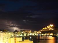
| A thunderstorm over Águilas By HunTeR - CC BY-SA 3.0 |

The city of Almeria.
Almería (UK: /ˌælməˈriːə/,[2] also US: /ˌɑːl-/,[3][4] Spanish: [almeˈɾi.a]) is a city and municipality of Spain, located in Andalusia. It is the capital of the province of the same name. It lies on southeastern Iberia on the Mediterranean Sea. Caliph Abd al-Rahman III founded the city in 955. The city grew wealthy during the Islamic era, becoming a world city throughout the 11th and 12th centuries. It enjoyed from an active port that traded silk, oil and raisins.
Intensive agriculture has been the most important economic sector of Almeria for the last 50 years. Nowadays, greenhouse’s production, handling and commercialisation of vegetables, and the supply industry of the sector, represent almost 40% of Almeria’s GDP. Directly, agricultural production accounts for 18.2% of the provincial GDP. In Andalusia, the average contribution is 6.6% and in Spain it is only 2.9%.
This situation is the result of a great dynamic model, which can continually incorporate new technologies: using soil sanding, plastic covers, drip irrigation systems, hybrid seeds, soil-less cultivation, irrigation programs, new greenhouse structures, and so on. They all allowed to improve production and increase commercialisation calendars, assuring the profitability and quality of the crops and the competitiveness of the markets. Moreover, Almeria’s economy has an important exporting vocation: 75% of production was sold abroad in 2018, with a value of 2.400 million euros. (*1)
 |
 |
 |
| Harbour of
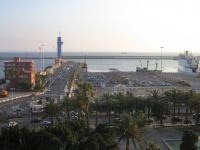
Almería By Pablo Enzo |
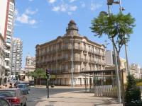
House of the Butterflies By Frank C. Müller - CC BY-SA 2.5 |
The ancient
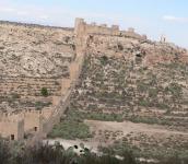
walls of Jayrán By Frank C. Müller - CC BY-SA 2.5 |

El Ejido surrounded by greenhouses.
El Ejido (Spanish pronunciation: [el eˈxiðo]) is a municipality of Almería province, in the autonomous community of Andalusia, Spain. It is located 32 km from Almería with a surface area of 227 km², and as reported in 2014 had 84,144 inhabitants. El Ejido is the centre of production for fruit and vegetables in the "Comarca de El Poniente". The work opportunities the city provides attract many foreign farmhands, who look for jobs mainly in the greenhouses there. Some greenhouses have begun using computer-controlled hydroponics systems, thus saving on labour, improving efficiency and the local economy.
In close proximity to the city along the coast line is situated Almerimar, a popular destination for tourism and relaxation. (*1)

Sierra Nevada in the background.
Sierra Nevada (Spanish: [ˈsjera neˈβaða]; meaning "mountain range covered in snow") is a mountain range in the region of Andalucia, in the province of Granada and, a little further, Málaga and Almería in Spain. It contains the highest point of continental Spain: Mulhacén, at 3,479 metres (11,414 ft) above sea level.
It is a popular tourist destination, as its high peaks make skiing possible in one of Europe's most southerly ski resorts, in an area along the Mediterranean Sea predominantly known for its warm temperatures and abundant sunshine. At its foothills is found the city of Granada and, a little further, Almería and Málaga.
Parts of the range have been included in the Sierra Nevada National Park. The range has also been declared a biosphere reserve. The Sierra Nevada Observatory and the IRAM radiotelescope are located on the northern slopes at an elevation of 2,800 metres (9,200 ft). (*1)

Approaching Motril.
Motril (Spanish pronunciation: [moˈtɾil]) is a town and municipality on the Mediterranean coast in the province of Granada, Spain. It is the second largest town in the province, with a population of 60,368 as of 2016. The town is located near the Guadalfeo River and 69 km (43 mi) from Granada. The council of Motril includes the city of Motril and the neighbourhoods of El Varadero, Carchuna, Calahonda, Puntalón, Playa Granada, Las Ventillas, La Perla, La Garnatilla and La Chucha. The town is the capital of the region of the Coast of Granada.
King Baudouin of Belgium died in Motril of heart failure during a visit to his summer residence, "Villa Astrida" in 1993.
Although its origin still remains unclear, it was a Phoenician enclave. It already existed in Roman times.
When the Christians conquered Motril, there were 2,000 inhabitants whose main activities were agriculture, fishing and the production of silk and sugar. The city centre size was around 3.5 km (2.2 mi). Outside the city there are two suburbs: Al-Majon suburb and al-Couruch suburb and a neighborhood called Jandara.
There was a Moorish uprising in 1569 that finished in 1570 with the Christians' victory.This made a recession of sugar production but this finished 5 years later with the repopulation of old Christians. By the end of 1600s, Nuestra Señora de la Cabeza church was built.
Sugar cane was the most important crop, which was later processed in the sugar refineries. The most important of these was "La Casa de la Palma". Now it's the place where the "Museo Preindustrial de la Caña de Azúcar" or Sugar Cane Museum is found.
In 1657, Philip IV granted Motril the title of city, separating its jurisdiction from Granada. At the beginning of the next century, Philip V distinguished Motril as "Muy Noble y Leal", which is now found on Motril's shield. After the War of Independence, in which Motril was occupied by French troops, the city started a new expansion of sugarcane and the sugar industry.
In the 19th century Motril participated in a singular event, it was proclaimed Independent Canton from July 22 to 25 of 1873. In a few years, due to the increase in the number of sugar refineries, it went to the first position in the Granada industrial ranking. It opened to the public on most traditional ride in the city, "Las Explanadas", in the mid-19th century. (*1)

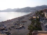
Getting to Almuñecar
Almuñécar (Spanish pronunciation: [almuˈɲekaɾ] < Arabic: al-munakkar) is a municipality in the Spanish Autonomous Region of Andalusia on the Costa Tropical between Nerja (Málaga) and Motril. It has a subtropical climate. Almuñécar lies in the province of Granada, and has around 26,514 citizens (2020). Since 1975, the town has become one of the most important tourist towns in Granada province and on the Costa Tropical; it has good transport connections and a football (soccer) stadium.
Almuñécar is an important setting in Laurie Lee's account of the outbreak of the Spanish Civil War in As I Walked Out One Midsummer Morning, and referred to as "Castillo" to disguise people's identities.
Almuñécar's coat of arms, which shows the turbaned heads of three Barbary pirates floating in the sea, was granted to the town by King Carlos I in 1526 for its having destroyed a Berber raiding force.
Almuñécar began as a Phoenician colony named Sexi, and even today, some of its inhabitants still call themselves Sexitanos. Under the Moors, Almuñécar blossomed as the fishing town of al-Munakkab (المُنَكَّب) or Ḥiṣn-al-Munakkab (حصن المنكب). Although the Phoenician and Roman history of the district was known from Greek and Roman sources it was not until the 1950s that significant archaeological evidence was discovered. (*1)
 |
 |
 |
| Beach of
Almuñecar By Paul Munhoven - CC BY-SA 3.0 |
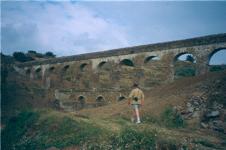
The Roman aqueduct in the Seco
River valley about 2 km (1 mi) north of Almuñécar By NoelWalley - CC BY-SA 3.0 |
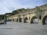
The Roman
aqueduct at Torrecuevas near the source of the Rio Verde about 4 km (2 mi) north of Almuñécar By NoelWalley - CC BY-SA 3.0 |

Velez-Malaga and the Mulhacen mountain
Vélez-Málaga (Spanish pronunciation: [ˈbeleθ ˈmalaɣa]) is a municipality and the capital of the Axarquía comarca in the province of Málaga, in the Spanish autonomous community of Andalusia. It is the most important city in the comarca. Locally it is referred to as Vélez. Vélez-Málaga is the headquarters of the Commonwealth of Municipalities of Costa del Sol-Axarquía. The municipality forms part of the Costa del Sol region.
Vélez-Málaga itself is a market city and "bustling market town and supply centre for the region's farmers", 4 km inland from Torre del Mar but unlike the coastal resort not dominated by the tourist industry
Mulhacén [mulaˈθen] is the highest mountain in the Iberian Peninsula. It is part of the Sierra Nevada range in the Cordillera Penibética. It is named after Abu l-Hasan Ali, known as Muley Hacén in Spanish, the penultimate Muslim King of Granada in the 15th century who, according to legend, was buried on the summit of the mountain.
Mulhacén is the highest peak in western Europe outside the Alps. It is also the third most topographically prominent peak in Western Europe, after Mont Blanc and Mount Etna, and is ranked 64th in the world by prominence.The peak is not exceptionally dramatic in terms of steepness or local relief. The south flank of the mountain is gentle and presents no technical challenge, as is the case for the long west ridge. The shorter, somewhat steeper north east ridge is slightly more technical. The north face of the mountain, however, is much steeper, and offers several routes involving moderately steep climbing on snow and ice (up to French grade AD) in the winter.
Mulhacén can be climbed in a single day from the villages of either Capileira or Trevélez, but it is more common to spend a night at the mountain refuge at Poqueira, or in the bare shelter at Caldera to the west. Those making the ascent from Trevelez can also bivouac at the tarns to the northeast of the peak. (*1)

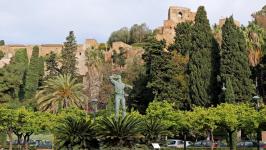
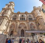
Overflying the city of Malaga
Málaga (/ˈmæləɡə/, Spanish: [ˈmalaɣa]) is a municipality of Spain, capital of the Province of Málaga, in the autonomous community of Andalusia. With a population of 578,460 in 2020, it is the second-most populous city in Andalusia after Seville and the sixth most populous in Spain. It lies on the Costa del Sol (Coast of the Sun) of the Mediterranean, about 100 kilometres (62.14 miles) east of the Strait of Gibraltar and about 130 km (80.78 mi) north of Africa.
Málaga's history spans about 2,800 years, making it one of the oldest cities in Europe and one of the oldest continuously inhabited cities in the world. According to most scholars, it was founded about 770 BC by the Phoenicians as Malaka. From the 6th century BC the city was under the hegemony of Ancient Carthage, and from 218 BC, it was ruled by the Roman Republic and then empire as Malaca (Latin). After the fall of the empire and the end of Visigothic rule, it was under Islamic rule as Mālaqah (Arabic: مالقة) for 800 years, but in 1487, the Crown of Castille gained control in the midst of the Granada War. The archaeological remains and monuments from the Phoenician, Roman, Arabic and Christian eras make the historic center of the city an "open museum", displaying its history of nearly 3,000 years.
The painter and sculptor Pablo Picasso, Hebrew poet and Jewish philosopher Solomon Ibn Gabirol and the actor Antonio Banderas were born in Málaga.
The most important business sectors in Málaga are tourism, construction and technology services, but other sectors such as transportation and logistics are beginning to expand. Málaga has consolidated as tech hub, with companies mainly concentrated in the Málaga TechPark (Technology Park of Andalusia). It hosts the headquarters of the region's largest bank, Unicaja, and it is the fourth-ranking city in Spain in terms of economic activity behind Madrid, Barcelona and Valencia. Regarding transportation, Málaga is served by the Málaga–Costa del Sol Airport and the Port of Málaga, whereas the city is connected to the high-speed railway network since 2007. (*1)
 |
 |
 |
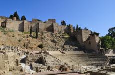
| Roman Theatre of
Malaga By Maksym Abramov - CC BY-SA 2.0 |
View of the old Alcazaba By Banja-Frans Mulder - CC BY 3.0 |
The Cathedral of
the Incarnation By Bengt Nyman - CC BY 2.0 |

After passing Malaga we fly straight to Gibraltar, over the Mediterranean
sea.

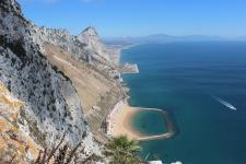
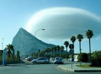
Final approach to the airport of Gibraltar.
Gibraltar (/dʒɪˈbrɔːltər/ jih-BRAWL-tər, Spanish: [xiβɾalˈtaɾ]) is a British Overseas Territory located at the southern tip of the Iberian Peninsula. It has an area of 6.7 km2 (2.6 sq mi) and is bordered to the north by Spain. The landscape is dominated by the Rock of Gibraltar at the foot of which is a densely populated town area, home to over 32,000 people, primarily Gibraltarians.
In 1704, Anglo-Dutch forces captured Gibraltar from Spain during the War of the Spanish Succession on behalf of the Habsburg claim to the Spanish throne. The territory was ceded to Great Britain in perpetuity under the Treaty of Utrecht in 1713. During the Napoleonic Wars and World War II it was an important base for the Royal Navy as it controlled the entrance and exit to the Mediterranean Sea, the Strait of Gibraltar, which is only 14.3 km (8.9 mi) wide at this naval choke point. It remains strategically important, with half the world's seaborne trade passing through the strait.Today Gibraltar's economy is based largely on tourism, online gambling, financial services and bunkering.
The sovereignty of Gibraltar is a point of contention in Anglo-Spanish relations because Spain asserts a claim to the territory. Gibraltarians rejected proposals for Spanish sovereignty in a 1967 referendum and, in a 2002 referendum, the idea of shared sovereignty was also rejected.
On 31 January 2020, the UK and Gibraltar left the European Union. In December 2020, the UK and Spain agreed in principle to a basis on which the UK and the EU might negotiate terms for Gibraltar to participate in aspects of the Schengen Agreement. (*1)
 |
 |
 |
| View of the Rock
of Gibraltar from the Mediterranean Steps By Uhooep - CC BY-SA 4.0 |
The Rock of Gibraltar (2010) By Viridianwindow - CC BY-SA 4.0 |
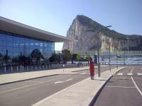
The new terminal
at Gibraltar Airport By Romazur - CC BY-SA 3.0 |
You can download for free this Flight Plan but only for your own private use. It is strictly forbidden to share it or publish it in other sites, forums, newsgroups or in any other way . You are encouraged to share and publish links to this page only, but not direct links to the file itself.
(*1) Credits: The descriptive texts are mainly an excerpt of those provided by Wikipedia. Visit Wikipedia to read the full descriptions.
See other MS Flight Simulator flight plans and instructions
Disclaimer: These instructions and flight plan are intended to be used only for MS Flight Simulator and should not be used for real flights.